Book a Club campsite
Explore hundreds of Club campsites and plan for stays throughout the year. There are plenty of locations to choose from, search and book today.
Book nowMark Sutcliffe takes in pretty pastureland and historic locks during a circular walk from Warwick Racecourse
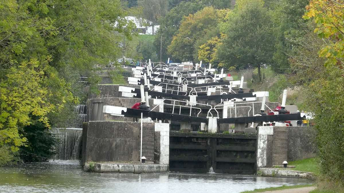
 Hatton Locks © Rob Farrow
This fascinating walk charts the evolution of the West Midlands from a largely rural economy to an industrial powerhouse by the end of the 19th century.
Starting from the gates of Warwick Racecourse Club Campsite the route heads across St Mary’s Lands, over the main railway line before joining the Grand Union Canal, formed to ferry coal to the power stations and factories of the Black Country.
We follow the canal for a couple of miles, climbing steadily beside the impressive flight of 21 locks – dubbed the ‘Stairway to Heaven’ by boaters when they widened in 1934 – which vlift canalboats some 45 metres up Hatton Hill.
After such thirsty work, a pause for lunch at the historic Hatton Arms – a former 18th-century coaching inn which is part of the 900-acre Hatton Estate owned by Johnnie Arkwright; the great-great-great-grandson of the inventor of the cotton spinning machine, Richard Arkwright – beckons. Once refreshed it is a case of heading back towards Warwick through the productive pastureland on the edge of the town, offering wonderful views of the skyline.
At a little under 11km this route is relatively flat and mostly well waymarked. It’s a thoroughly rewarding ramble during the summer months or, indeed, at any time of the year.
Download this route and others to your smartphone or GPS device from the Club’s Outdooractive page at: out.ac/IPp3bt

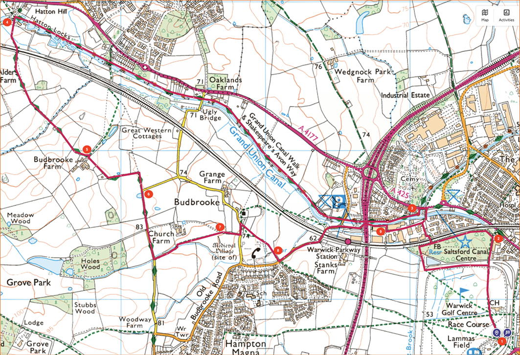
1. From the site’s main gate, head left and then follow a grassy path diagonally up to woodland on the skyline. Continue straight ahead past a golf course on the grassy path between the trees. Walk straight across the racetrack and continue through a kissing gate and straight ahead into woodland.
2. 0.8km – At the far side of the woods, head left on the perimeter path alongside the railway then, after 400m, take a footpath to the right over a railway bridge, following the walkway through the business park to join the access road to the canal. Cross the canal, head left on the pavement over another bridge then left again on a footpath into a housing estate then through a gap in a hedge to emerge onto the canal towpath.
3. 1.4km – Head right along the towpath under the main road for just over a mile, climbing steadily past a series of locks to reach Hatton Locks. Halfway up the flight of locks ascending Hatton Hill, head left over a footbridge across a lane, down some steps and through a gate into a country park.
4. 5.1km – Cross the field and over the railway and continue diagonally through the next two fields to a footbridge. Continue over the footbridge and through fields towards Budbrooke Farm. Go through a kissing gate, head left of a farm and continue towards the spire of St Mary’s Church in Warwick.
5. 5.7km – Go through the next gate, veer right then back left onto a gravel track between farm buildings and a field. Follow the track left then back right between fields to join a lane.
6. 6.5km – Continue along the lane for 300m and, beyond Church Farm, head left through a gate along a field boundary. After 150m go left through a gate over a dyke then right along a grassy path past farm buildings and through a kissing gate, then slight left diagonally across the next field to a stile in the corner of a field.
7. 7.4km – Continue over the stile onto a farm track then turn left at a junction and along a lane for 30m. Head right through St Michael’s Church car park and through a gate onto a path. Follow the fence around a garden then through a gate and continue along this line to a kissing gate on the far side of a field.
8. 7.9km – Continue through the scrub to Old Budbrooke Road and head left along the pavement under a bridge and past Warwick Parkway Station, then immediately right down an access road and left onto the canal towpath under the A46.
9. 8.9km – Where the towpath ends, head right into a business park then left along a road to briefly rejoin the walkway beside Wilmhurst Road on your outbound route just before waypoint 3. Head right over a railway bridge then right to reach the edge of woods beside some ponds. Continue left along the perimeter of the racecourse to return to the Club site.